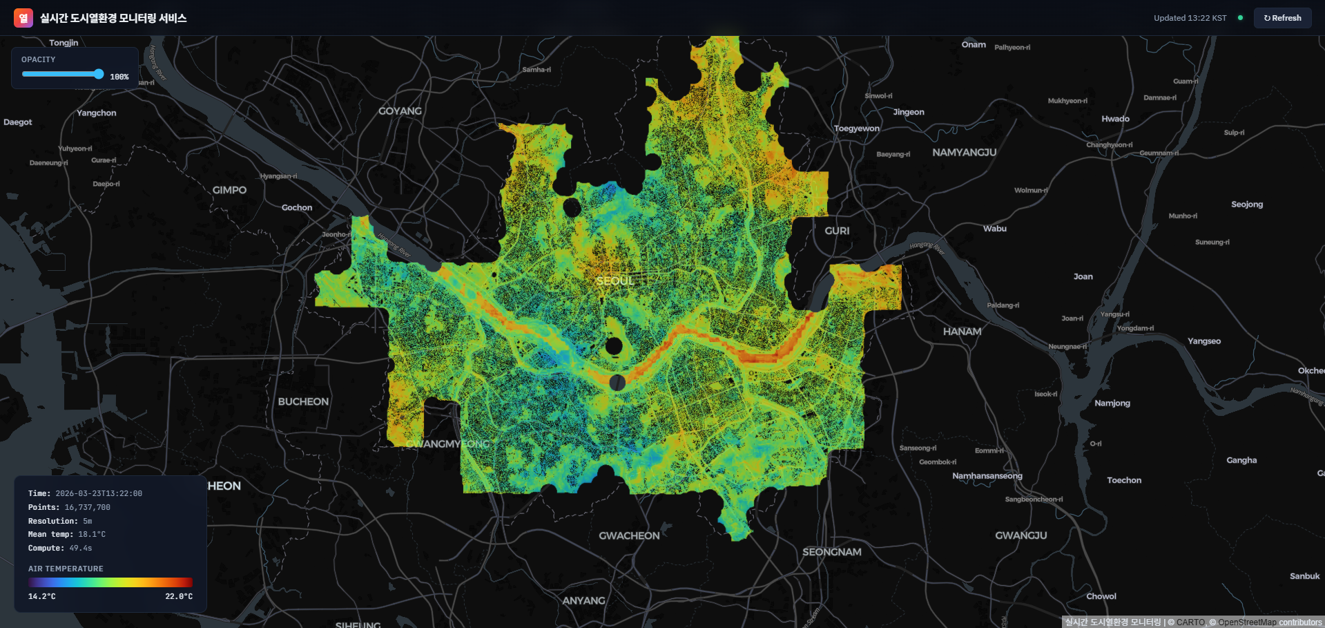
A Real-time Urban Microclimate Prediction Service
A web-based service has been developed for real-time prediction of air temperature across Seoul at individual grid points, combining KMA AWS/ASOS observations with urban morphology data. While conventional urban heat island studies have relied on satellite thermal imagery or numerical models with limited spatiotemporal resolution, this work achieves point-level temperature prediction at 10m resolution using an XGBoost-based machine learning model.
The model learns residuals between S-DoT sensor observations and IDW-interpolated AWS temperatures, using 151 input features. These include meteorological observations (temperature, wind, humidity, solar radiation, etc.), temporal characteristics (UHI phase, solar elevation, etc.), urban morphology indices derived from the National Geographic Information Institute's (NGII) 1:1,000 digital topographic maps at four resolutions (10m, 100m, 250m, 1000m) including building height, SVF, canyon width, building coverage ratio, and FAI, as well as land cover fractions extracted from the Ministry of Environment's detailed land cover map (세분류 토지피복지도, 41 classes).
The validated model achieves an MAE of 0.753°C and can produce city-wide temperature distributions for approximately 1.2 million grid points within 30 seconds at 10m resolution. Predictions are stored as GeoTIFFs and visualized through a real-time interactive web map.
The service can support urban heat island analysis, redevelopment scenario evaluation, and heat wave response planning, demonstrating its potential as a decision-support tool for urban thermal environment management.